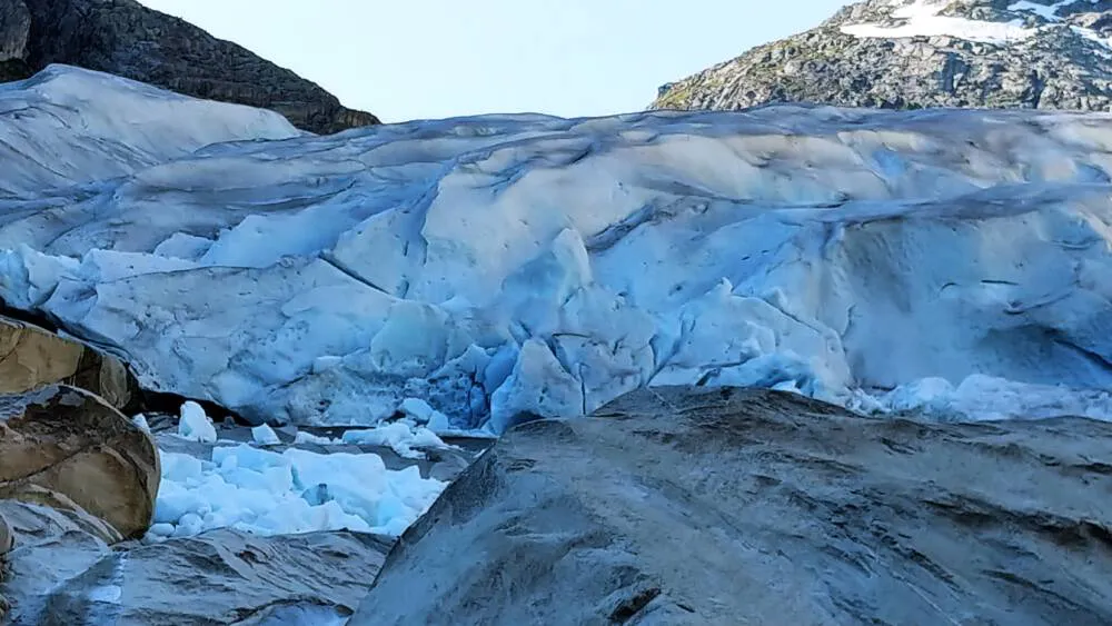
The new maps show that the total area of glaciers in Norway is 2328 km2. This is a decrease of 14 percent compared to the 1999-2006 period. The melting of glaciers has also led to the emergence of new glacial lakes at the edge of the glaciers. The NVE survey of glacial lakes shows that more than 350 new glacial lakes have formed.

- A new study shows that some small glacial units have disappeared since the previous study, all of which are located in northern Norway. In addition, many small glaciers and formations have almost disappeared, says Liss glacier researcher M. Andreassen.
Notable glaciers that will soon disappear include Breifonn, Rogaland's largest glacier, and Vegdalsisen in Nordland. Another glacier that has almost disappeared since the previous survey is the small glacier at Møre og Romsdal.
The largest change in the glacier area is in Nordland with a change of 186 km2 (20%), followed by Vestland with a loss of 91 km2 (8%) and Troms and Finnmark with a loss of 64 km2 (24%). Rogaland, Vestfold and Telemark fell the most by percentages.
Satellites were used to map glaciers
Glaciers are part of Norwegian nature. They are very sensitive to climate change and either shrink or expand as it changes. Glaciers in Norway have already been mapped several times from topographic maps, aerial imagery and satellite imagery.
NVE re-mapped glaciers and formations in Norway using Sentinel-2 satellite imagery from 2018 (Northern Norway) and 2019 (Southern Norway). The total area of glaciers in Norway is 2328 km2, which has decreased by 14% since the previous survey, which was done with Landsat satellite imagery in 1999-2006. Sixty percent of the glacier area is in southern Norway, while 40 percent is in northern Norway.
Melting glaciers also led to the appearance of new lakes
- Several smaller glaciers and formations have emerged in this mapping study. This is because the Sentinel-2 satellite imagery has a better resolution than the Landsat satellite imagery we used in the previous atlas (10m instead of 30m). Therefore, we can now map many smaller units. This is also due to the fact that many glaciers have split into several parts due to melting, says Andreassen.
The melting of glaciers has also led to the emergence of new glacial lakes at the edge of the glaciers. A study by the NVE shows that more than 1999 new glacial lakes have formed since the previous mapping in 2006-350. Many of them are quite small. Several lakes no longer come into direct contact with the glacier due to melting in recent years.
The new NVE publication provides an overview of the total glacier area by province and the largest glaciers in the country. There are also many other facts about Norway's glaciers and formations.
Photo: Wojtek Sobieski
Source: Norwegian Directorate of Water Resources and Energy (NVE)
Find out more and read: Norway doubles climate funding to NOK 14 billion
